Dangerous Routes: Why Rescuers Advise Against Using Google Maps in the Mountains
Mountain rescue teams warn tourists against relying on standard navigation apps in complex terrain and emphasize the importance of basic orientation skills.
 🎓Education
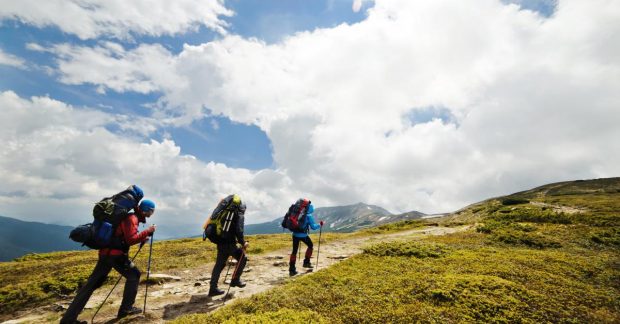
Photo: UNIAN
Key points
- Rescuers urge people not to use Google Maps for mountain hiking.
- Standard navigation apps fail to show 3D terrain and dangerous obstacles.
- Paper maps and compasses remain the safest navigation tools.
Modern technology has greatly simplified everyday life, but trying to apply familiar urban habits to the wild outdoors can sometimes lead to danger. Recently, rescue services have increasingly reported cases of young travelers getting lost in mountainous regions because they rely entirely on mobile applications like Google Maps.
Why standard maps fail in the mountains
Experts point out that such services are designed primarily for roads and urban infrastructure, meaning they fail to display complex terrain features such as steep rocky cliffs, elevation changes, or narrow hiking paths. Due to the lack of these details, users form a false impression of their route and risk becoming trapped. Furthermore, a dead battery or lack of mobile signal in the mountains instantly turns a smartphone into a useless piece of equipment.
How to prepare for a safe hike
Professional instructors advise not to abandon digital devices completely, but rather to combine them with traditional tools. A basic setup—a paper topographic map and a compass—remains the most reliable lifesaver in a critical situation. For those just mastering orientation skills, specialists recommend starting with familiar routes or seeking guidance from more experienced hikers.
Source UNIAN — unian.ua/tourism/lifehacking/yak-oriyentuvatisya-na-miscevosti-pid-… ↗
Read next
 🛡️Security
Frontline Update: Over 100 Clashes Recorded, High Intensity of Attacks in Pokrovsk Direction
A total of 131 combat clashes were recorded along the frontline over the past day, with Russian forces showing the highest activity in the Pokrovsk and Kostiantynivka dir…
 🛡️Security
Russian ship Sparta II continues to burn in Gulf of Finland after drone attack
Emergency crews in Finnish territorial waters are still battling a fire aboard the Russian cargo vessel Sparta II, previously hit by Ukrainian drones.
 🛡️Security
Search for 14 Missing People Underway in Dymer, Kyiv Region, Following Drone Attack
A nighttime Russian drone strike partially destroyed an apartment building in Dymer, Kyiv region, triggering a large-scale rescue operation as 14 residents remain unreach…
 💼Economy
A mobile clinic in nearby Rivne offers free testing for HIV and hepatitis
Residents of the neighboring region can check their health anonymously at a special mobile unit as part of a European initiative.
 🏙️City
American Singer Miley Cyrus Marries for the Second Time
Renowned artist Miley Cyrus has secretly married musician Max Morando in Palm Springs.
 🏙️City
Swedish Benefactors Deliver 42 Hospital Beds and Specialized Equipment to Hoscha Hospital
The Hoscha Multiprofile Hospital has received a humanitarian shipment from Sweden, including specialized beds, mattresses, and patient care equipment.